6 Best Sights in Moab and Southeastern Utah, Utah

Valley of the Gods

Fodor's choice

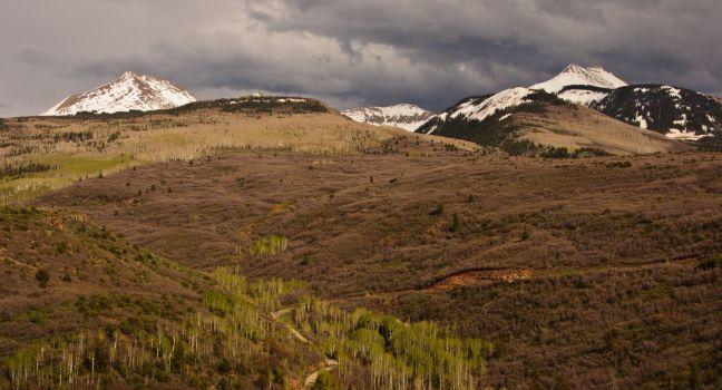
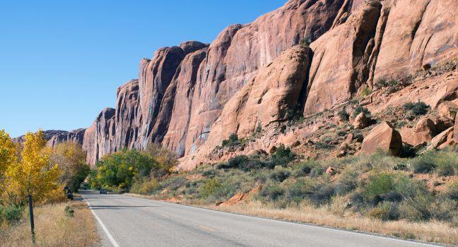
A red fairyland of slender spires and buttes, the Valley of the Gods is a smaller version of Monument Valley. Approximately 15 miles west of Bluff, you can take a pretty drive through this relatively unvisited area on 17-mile-long Valley of the Gods Road, which begins on U.S. 163 and ends on Highway 261. The road is unpaved but should be drivable as long as it's dry.

Canyon Rims Recreation Area

If you have a few hours to spare (or a night if you enjoy backcountry camping), you can enjoy two remarkable canyon-country vistas. Turn off U.S. 191 at a point between Moab and Monticello (about 32 miles south of Moab and 26 miles north of Monticello), and the paved Needles Overlook Road runs 22 miles west to Needles Overlook, which takes in the southern end of Canyonlands National Park. Less than 20 miles farther on a graded road is the Anticline Overlook, with a view that encompasses the Colorado River, Dead Horse Point, and other locales to the north.

La Sal Mountain Loop

La Sal Mountain Loop
EastVillage Images / Shutterstock

With beautiful lakes and welcoming shade, these mountains outside Moab offer cool relief from the desert's hot summers, and striking scenery as the aspen leaves turn gold in the fall. On Old Airport Road (a left turn off U.S. 191) 8 miles south of Moab, the 62-mile loop climbs over the laccolith mountain range, affording some great vistas of the valley. The road enters La Sal Division of the Manti-La Sal National Forest just as the dominant red-rock cliffs east of Moab begin to alternate with sagebrush and juniper flats. Passing through the cool heights of La Sal Mountains, the loop winds north through red rock country to Castle Valley and an intersection with Highway 128. The road is paved, except for a couple of gravel sections, but it has steep switchbacks, and it does become snow-packed in winter. Check with the National Forest Service before embarking on winter driving on this road as some sections may be closed.

Recommended Fodor's Video

Lower Colorado River Scenic Byway—Highway 279

Lower Colorado River Scenic Byway—Highway 279
IrinaK / Shutterstock

If you're interested in Native American rock art, Highway 279 northwest of Moab is a perfect place to spend a couple of hours immersed in the past. To get there, go north from Moab on U.S. 191 for about 3½ miles before turning left onto Highway 279. If you start late in the afternoon, the cliffs will be glowing orange as the sun sets. Along the first part of the route you'll see signs reading "Indian Writings." Park only in designated areas to view the petroglyphs on the cliff side of the road. At the 18-mile marker you'll see Jug Handle Arch. A few miles beyond this point the road turns to four-wheel-drive only and takes you into the Island in the Sky District of Canyonlands. Do not continue onto Island in the Sky unless you are in a high-clearance four-wheel-drive vehicle with a full gas tank and plenty of water. Allow about two hours round-trip for the scenic byway drive.

If you happen to be in Moab during a heavy rainstorm, Highway 279 is also a good option for viewing the amazing waterfalls caused by rain pouring off the cliffs on both sides of the Colorado River.

Moki Dugway

Northwest of the Valley of the Gods, Highway 261 takes you to the Moki Dugway, a graded road that was bulldozed out of a cliff during the uranium boom. It's been improved since it was originally built, but its steep grade and tight switchbacks still provide thrills sufficient for most drivers. From the top of the cliff you're rewarded with outrageous views south over the Navajo Reservation with Monument Valley visible more than 20 miles away. This drive is not recommended for vehicles more than 28 feet in length or weighing more than 10,000 pounds.

Hwy. 261, 9 miles north of Hwy. 163, Mexican Hat, Utah, 84531, USA

Muley Point Overlook

Five miles beyond the Moki Dugway turnoff on Highway 263 brings you to the Muley Point Overlook, which has a panoramic view of the Goosenecks of the San Juan River, the Valley of the Gods, and Monument Valley. It's also 1,000 feet higher in elevation than the Goosenecks overlook farther south.