5 Best Sights in Lake Tahoe, California

Emerald Bay State Park

Fodor's choice
Emerald Bay State Park
Kit Leong / Shutterstock

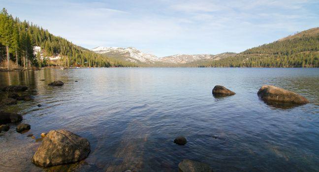
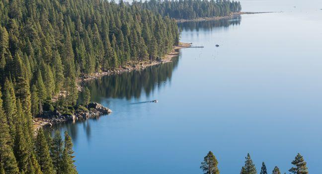
Millions of years ago, a massive glacier carved this 3-mile-long and 1-mile-wide fjord-like inlet. Famed for its jewel-like shape and colors, the bay surrounds Fannette, Lake Tahoe's only island. Highway 89 curves high above the lake here; from the Emerald Bay lookout, the park's centerpiece, you can survey the whole scene. The bay is one of Lake Tahoe's don't-miss views. The light is best in mid- to late morning, when the bay's colors pop.

D.L. Bliss State Park

This park, which shares 6 miles of shoreline with Emerald Bay State Park, takes its name from Duane LeRoy Bliss, a 19th-century lumber magnate who once owned nearly 75% of Tahoe's lakefront. Emerald Bay and D.L. Bliss parks cover 1,830 acres, 744 of which the Bliss family donated to the state. At the north end of Bliss is Rubicon Point, which overlooks one of the lake's deepest spots.

Short trails lead to an old lighthouse and the 250,000-pound Balancing Rock, perched atop a fist of granite. The 4.5-mile Rubicon Trail—a premier Tahoe hike—leads to Vikingsholm (part of Emerald Bay State Park), providing stunning views along the way. Two white-sand beaches front some of Tahoe's warmest water. When the Bliss roads close for the winter, park in the visitor center lot and hike 1 mile to the Rubicon trailhead.

Donner Memorial State Park and Emigrant Trail Museum

Donner Memorial State Park and Emigrant Trail Museum
Jeffrey M. Frank / Shutterstock

The park and museum commemorate the 89 members of the Donner Party, westward-bound pioneers who became trapped in the Sierra in the winter of 1846–47 in snow 22 feet deep. Barely more than half survived, some by resorting to cannibalism. The absorbing Emigrant Trail Museum in the visitor center contains exhibits about the Donner Party, regional Native Americans, and railroad and transportation development in the area. In the park, you can picnic, hike, camp, and go boating, fishing, and waterskiing in summer; winter brings cross-country skiing and snowshoeing on groomed trails.

Recommended Fodor's Video

Ed Z'berg Sugar Pine Point State Park

Summer visitors love to hike, swim, fish, and tour the Hellman-Ehrman Mansion at this park named for a state politician who championed conservation, but it's also popular in winter, when a small campground remains open. Nearly 12 miles of cross-country ski and snowshoe trails allow beginners and experienced enthusiasts alike to whoosh through pine forests and glide past the lake. Rangers lead full-moon snowshoe tours from January to March. With 2,000 densely forested acres and nearly 2 miles of shore frontage, this is Lake Tahoe's largest state park.

Van Sickle Bi-State Park

Heavenly Gondola cars glide above this 756-acre day-use-only park that straddles the California–Nevada border steps south of Heavenly Village. Several trails wind up the mountain to sigh-worthy vistas. Colorful spring wildflowers and fall foliage provide further incentive to bring a picnic and hike, bike, or ride horseback. The park's Rim Trail Connector leads to the Tahoe Rim Trail, which for more than 165 miles follows the ridge lines of the mountains surrounding Lake Tahoe.