6 Best Sights in Banff National Park, Alberta

Icefields Parkway

Fodor's choice
Icefields Parkway
BGSmith / Shutterstock

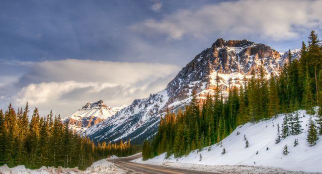
Powerfully rugged mountain scenery, glaciers, waterfalls and icefalls, and wildlife: the Icefields Parkway reveals all of these and more as it snakes its way along the 230 km (143 miles) connecting Banff National Park with Jasper National Park. It is an absolute highlight of the Canadian Rockies.

You could drive this winding road in three to four hours, but your trip will more likely take a full day when you add in stops. The road rises to near the tree line at several points, and the weather can be chilly and unsettled at these high elevations, even in midsummer, so it's a good idea to bring warm clothing along. Only one gas station, open seasonally, operates on the parkway, so check your car's gas gauge before setting out.

Elk, moose, deer, and bighorn sheep are fairly common, and occasionally bears and mountain goats come into view. In summer, alpine wildflowers carpet Bow Pass and Sunwapta Pass. The most dramatic scenery is in the northern end of Banff National Park and the southern end of Jasper National Park, where ice fields and glaciers become common on the high mountains flanking the parkway. (Ice fields are massive reservoirs of ice; glaciers are the slow-moving rivers of ice that flow from the ice fields.) Scenic overlooks and signposted hiking trails abound along the route.

Barrier Lake

Picnic tables, indoor toilets, a boat launch, a visitor center, free Wi-Fi access, and lovely views are the draws at this day-use area in Kananaskis Country.

Bow Glacier Falls, Bow Lake, Crowfoot Glacier, and Simpson's Num-Ti-Jah Lodge

You may wish to stop at Bow Lake for the regional Canadian cuisine at Simpson's Num-Ti-Jah Lodge at Bow Lake, but you don't have to dine or stay here to enjoy the trails and views of the lake and Crowfoot Glacier. A trail leads from the bottom of the parking lot to the base of Bow Glacier Falls, where you can feel the spray, hear the roar of the falls, and witness the birth of a river. The Bow River is part of western Canada's largest watershed. The hike is about 4 km (2½ miles) one-way and takes from 1½ to 3 hours to complete depending on how many photos you take.

Recommended Fodor's Video

Canmore

About 25 km (15 miles) southeast of Banff, Canmore became a modest boomtown with the 1988 Olympic Games. Many of its residents feel that the commute to Calgary for work is a fair trade-off for living in the mountains. For tourists, Canmore makes a good base for exploring Kananaskis Country and Banff National Park.

Kananaskis Country

Three provincial parks make up the 4,200-square-km (1,600-square-mile) recreational region known as Kananaskis Country, whose northern entrance is 26 km (16 miles) southeast of Canmore. The area includes grand mountain scenery, and though it's not quite a match for that in the adjacent national parks, Kananaskis allows some activities the parks prohibit, including snowmobiling, motorized boating, and off-road driving. There are also spectacular cross-country and mountain-biking trails.

The main route through Kananaskis Country is Highway 40, also known as the Kananaskis Trail. It runs north–south through the front ranges of the Rockies. Only the northern 40 km (25 miles) of the road remain open from December to mid-June, in part because of the extreme conditions of Highwood Pass (at 7,280 feet, the highest drivable pass in Canada), and in part to protect winter wildlife habitats in Peter Lougheed Provincial Park. Highway 40 continues south to join Highway 541 west of Longview. Access to East Kananaskis Country, a popular area for horseback trips, is on Highway 66, which heads west from the town of Priddis.