One does not simply walk into Mordor, indeed.
The mountain’s black cone materialized through gusts of cold, lacy fog. The occasional whiffs of sulfur emanating from a steaming yellow gash behind me served as a potent reminder: You’re standing next to an active volcano, and it could kill you at any moment.
The active volcano in question was New Zealand’s Mount Ngauruhoe, which I circumnavigated in a four-day, 28-mile jaunt that ranks as one of New Zealand’s ten vaunted Great Walks, the Tongariro Northern Circuit. The trek is one of several routes through Tongariro National Park, the country’s most visited national park.
Tongariro National Park’s three active volcanoes (eruptions have happened here as recently as 2012) are visual evidence of New Zealand’s feisty geology, with earthquakes and eruptions posing a very real threat. Ngauruhoe, one of the three, is most popularly known for its moment in the spotlight as Mount Doom in the film versions of The Lord of the Rings and The Hobbit. But it’s more than a Hollywood movie set; it’s also an area held sacred by the Māori, who have sought spiritual connection here for generations.
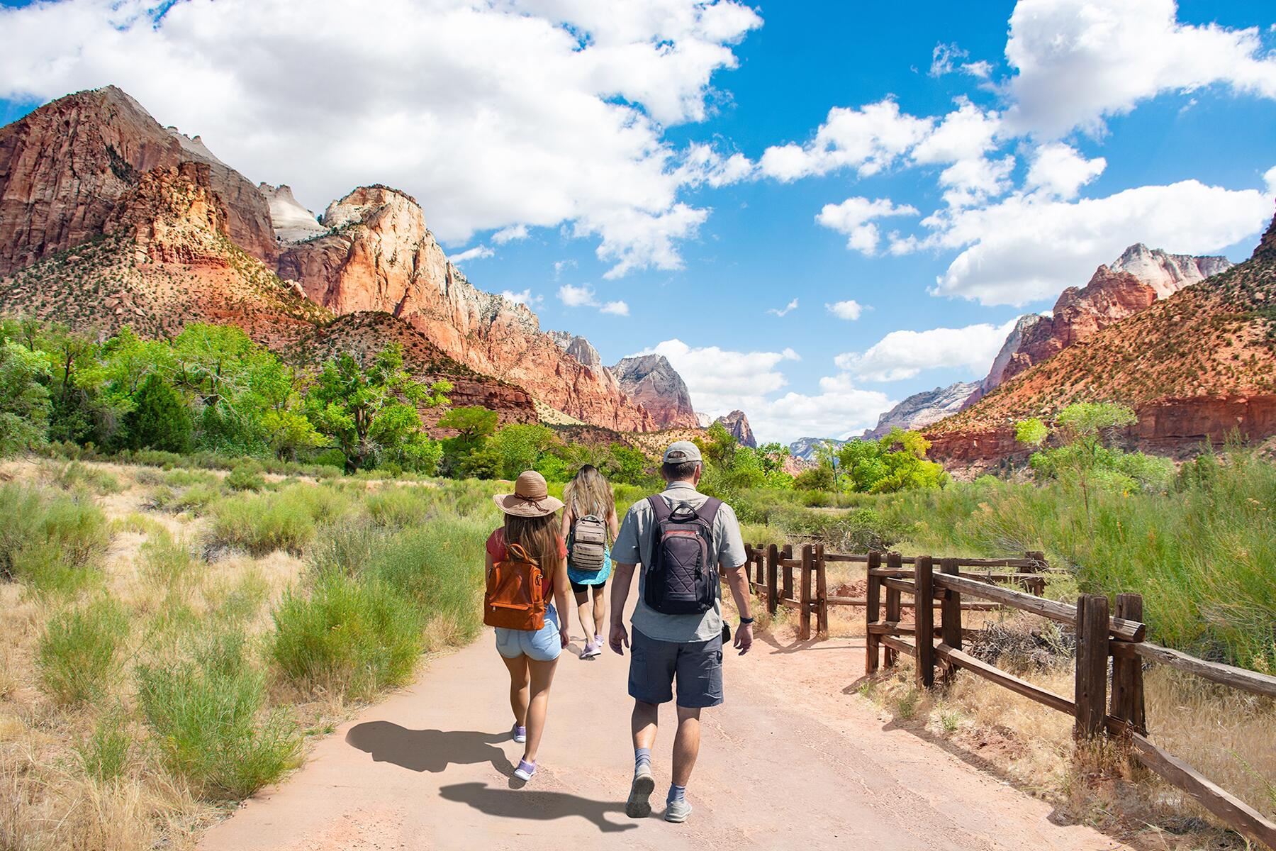
Most hikers who come to this part of the north island undertake only the Tongariro Alpine Crossing, a famed one-day walk that traverses some of the region’s most dramatic scenery. But I came to see Ngauruhoe in 360-degree glory. My two trekking buddies and I pitched our tents amid wild berry bushes, amber grasses, and ancient lava flows. We were rewarded with three sunsets that painted Mount Ngauruhoe in amber alpenglow. And hey—we didn’t die.
Recommended Fodor’s Video

Our introduction to the dangers of walking alongside an active volcano came almost as soon as we set down our packs at our first night’s destination, Mangatepopo Hut. Posted on one of the hut’s exterior walls was a sign reading “Volcanic Hazards at Tongariro,” listing events like lava flows, pyroclastic flows, and ashfall, and mapping the valleys that could potentially funnel these hazards toward our disintegrable bodies. Nearby, we found another sign entitled “Action Plan for Eruption Response for Huts,” describing the protocol should any of these volcanos wake up and start blowing chunks.
In the event of a volcanic episode, we were told that night at a ranger talk, we were to move to high ridges and avoid the aforementioned valleys of hot lava. The huts, which we camped next to, are also constructed in safe zones—we could have ducked inside, and chances are we would have been out of the harm’s way. Rangers would then have organized evacuations if needed.
The more present danger came on the second day when our route overlapped with the Tongariro Alpine Crossing. It’s widely lauded as the country’s single best day hike, but the hordes of people who come to take it on can be unprepared for the fury this slice of our trip could unleash. In this alpine environment, weather can change quickly, leaving us exposed to lightning strikes, extreme cold, and fog so thick the trail disappears—a sometimes fatal occurrence. There’s no water on the trail, which is often punishingly hot and moisture-sapping. And it’s overall a taxing journey, a trek that can test even the fittest hikers. We came prepared to ward off both heat exhaustion and hypothermia. One does not simply walk into Mordor, indeed.

Starting the Crossing, the red streaks on the dark cone of Nguaruhoe came into sharper focus as we hiked across fields of volcanic vomitus. Climbing a steep, crumbly slope nicknamed The Devil’s Staircase, we were swallowed up by wisps of fog that thickened as we ascended higher. Our blue sky turned gray, and our visibility shrunk to a few feet. A cold wind picked up, and I stopped to add a layer.
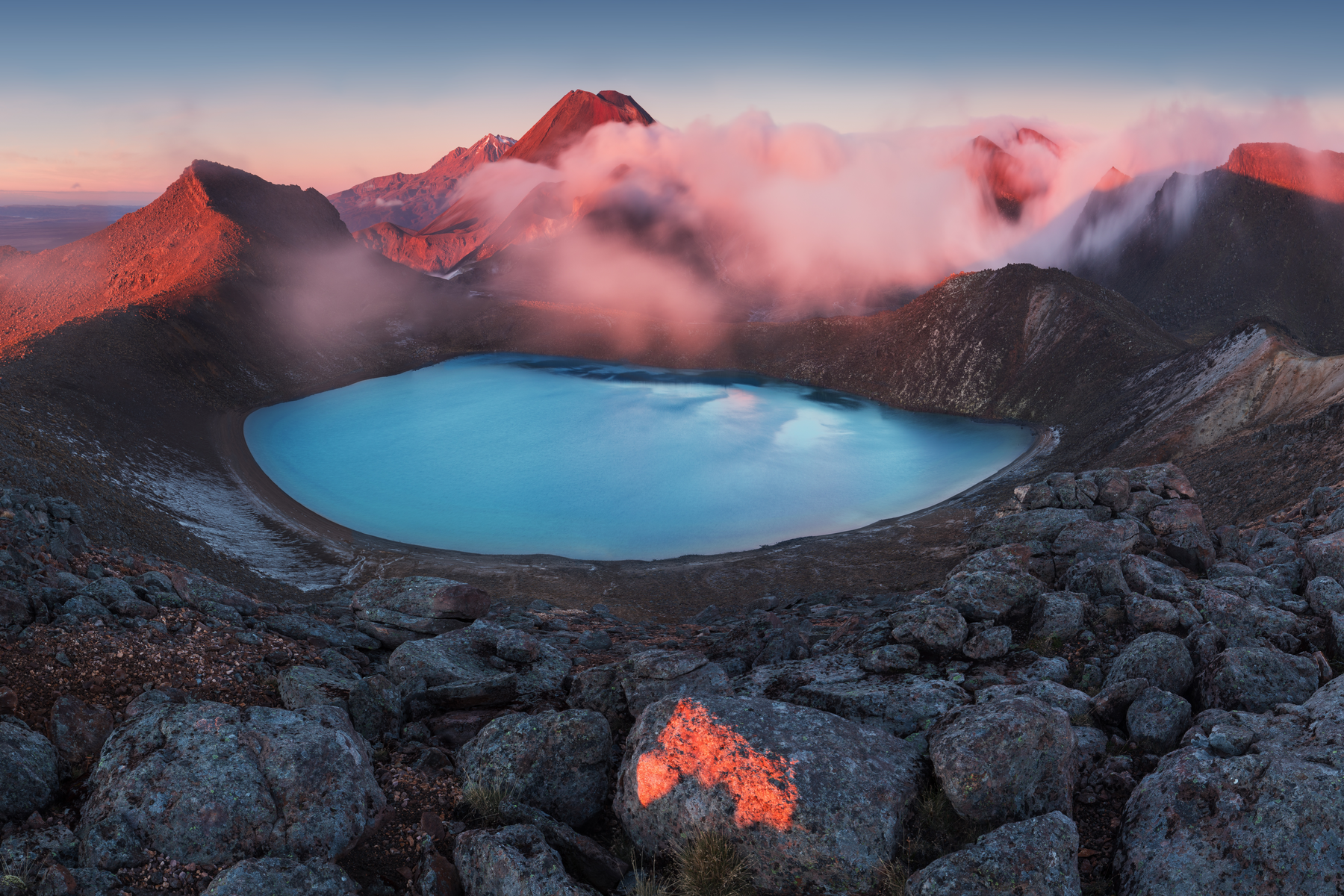
Reaching the end of the climb, we stood on the exposed saddle linking Ngauruhoe with the smaller, less dramatic shoulder of the Tongariro volcano. The fog broke up enough that we could see our route ahead of us. We traversed the edge of Red Crater, a dramatic ochre gash serving as evidence of the great tectonic violence this place is capable of. In the distance, I could see the perfect white cone of Mount Taranaki, 86 miles to the west. Peering down the jagged landscape, we remarked over the Emerald Lakes, three former explosion pits that are now filled with milky green water and surrounded by sulfurous fumaroles.
Ngauruhoe is New Zealand’s youngest and most historically active volcano in one of the most tectonically unstable countries in the world. It’s no wonder, then, that director Peter Jackson chose this landscape to sub in for Mordor and Ngauruhoe—and occasionally, nearby Ruapehu—for Mount Doom when he made the film versions of J.R.R. Tolkien’s The Lord of the Rings and The Hobbit. Mount Doom features heavily in the trilogy’s final scenes, where Frodo Baggins scales the mountain to destroy the One Ring.
While that fact gets the park a lot of attention, this place had cultural significance long before Hollywood came knocking. The alpine lakes here, along with the peaks, are sacred to the local Māori tribe, Ngāti Hikairo ki Tongariro, which regards the landscape as a place of spiritual connection to the environment. Though my dated hiking guidebook encouraged climbing of Ngauruhoe, in 2017 the Department of Conservation took down signs pointing hikers to the summit route. Though a few climbers still scramble up the mountain, it’s considered disrespectful of the Māori to do so. Swimming in any of the park’s lakes is also forbidden.
Tongariro National Park was born from the foresight of the paramount chief of the Ngāti Tūwharetoa tribe, Horonuku Te Heuheu, who gave the land to the Crown in 1887 amid fears it could be divided and sold. In 1894, Tongariro became New Zealand’s first national park–and just the fourth in the world–a historic decision that has kept this land as pristine as possible. It’s well-deserving of our respect.
It was easy to forget the dangers around us.
Later in the trip, the landscape—a desert formed by two million years of desiccating eruptions that wiped out all vegetation and replaced it with chalky pumice—became a bit more monotone and less noticeably explosive. It was easy to forget the dangers around us. We stargazed at night, bathed in clear streams, drank cans of Marlborough rosé, and chatted with our fellow trampers. We flirted with fantails, extroverted little birds that like to show off their long tailfeathers and hop surprisingly close to humans. We hiked at a leisurely pace, no agenda to speak of—without the stress of having to toss a contested piece of jewelry into a pit of fire at the top of a massive mountain and save the world, for example.
We finished the trail where we started, barely getting back to the visitor center before a rainstorm moved in. And we were grateful that, for those four days at least, Ngauruhoe stayed fast asleep.