
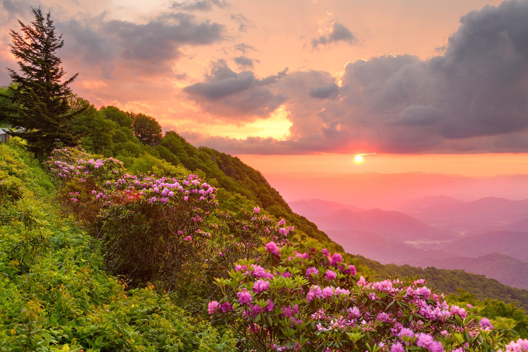

Beware these road trips outside of the summer months.
Road trips are always “in season.” But there are admittedly certain roadways that weren’t made for winter exploration, with seasonal safety closures due to snow and ice. But the byways that are at these higher elevations oftentimes offer even greater rewards when they are traversable in higher temperatures. Motorists can enjoy unparalleled alpine sights of scenic vistas and panoramic passes that can only be seen at certain times of the year, making them all the more special for planning a dedicated trip to explore. Here are 12 of the most scenic seasonal summer drives across America for an unforgettable warm-weather road trip.
Top Picks for You
Chinook Pass Scenic Byway
WHERE: Washington
Washington’s Chinook Pass Scenic Byway travels from the rolling fields of the town of Enumclaw west of the Cascades to the fertile grounds of Naches Valley. The byway begins with majestic sights of the 14,410-foot-tall Mount Rainier against the skyline. Must-stop destinations include the town of Greenwater, a historic spot to stretch and grab a bite before Skookum Falls, a 250-foot cascading waterfall visible from the road along the west side of the White River. There’s also the Mount Rainier Sunrise Visitor Center and Washington’s largest ski resort—Crystal Mountain—which offers 2,600 acres of explorable acres for snowsports lovers. Next is Tipsoo Lake—an iconic and frequently photographed lake with a mirror reflection of Mount Rainier, and finally, Boulder Cave Recreational Area. The route ends in Naches—a quaint community 13 miles northwest of Yakima near the banks of the Naches River.
Eastern Sierra's Tioga Pass and the June Lake Loop
WHERE: California
Reaching 9,943 feet in elevation, the dramatic Tioga Pass Road (Highway 120), which is California’s highest mountain pass, links Mono County to Yosemite National Park’s only east entrance. Tioga Road is a gorgeous, 64-mile-long byway that connects Big Oak Flat to Lee Vining. It’s traditionally closed for the winter months from November through late May each year—but when it’s open, road trippers can enjoy access to the scenic and sometimes lesser-known attractions of the East side of Yosemite (such as Tuolumne Meadows, Tenaya Lake, and Olmsted Point). Extend the road trip by traveling further down Highway 120 to another seasonal scenic roadway, Highway 158—also known as the “June Lake Loop.” While traveling in the region, head over to the Mammoth Lakes area and explore Reds Meadow Road which is closed in the winter but goes up to the geologic masterpiece, The Devil’s Postpile National Monument.
Recommended Fodor’s Video
Medicine Wheel Passage
WHERE: Wyoming
The Medicine Wheel Passage in Wyoming is a rugged, nearly 30-mile route typically open from Memorial Day through mid-November. It’s the northern-most route across the Bighorn National Forest in the Big Horn Mountains. The steep road starts in Ranchester, north of Sheridan, following U.S. Highway 14A with rare views of Fallen City and Steamboat Point with ample stops for picnicking and hiking. Enjoy impressive sights of the Bighorn Basin below, and stop at Observation Point, perched at 9,430 feet. Take a short hike to see the Medicine Wheel/Medicine Mountain National Historic Landmark—but be respectful of the monument’s spiritual significance. After arriving at Burgess Junction, stay on the route to continue to merge onto Highway 14 toward Lovell (where the route becomes known as the Big Horn Scenic Byway) and continue on this scenic journey all the way toward the larger town of Cody (and beyond!).
Trail Ridge Road Scenic Byway
WHERE: Colorado
The Trail Ridge Road Scenic Byway (U.S. Highway 34) is appropriately nicknamed “Highway to the Sky”—and it’s no secret why since it tops out at 12,183 feet. In fact, much of this drive is actually above the tree line and crosses the continental divide. This journey is a roughly two-hour scenic route that starts in from Winter Park, connecting Estes Park to Grand Lake while showcasing sweeping vistas of the most gorgeous scenery of the Rockies—as well as many other unparalleled sights of wildlife and nature. Keep an eye out for marmots, bighorn sheep, and even moose. Another special fact about Trail Ridge Road is that it’s the highest road in the U.S. that is paved for the entirety of its length. This map offers a more visual sense of its route. It’s typically open from Memorial Day through mid-October.
Donner Pass
WHERE: California
Donner Pass is a paved Tahoe road that’s technically “open year-round” but it almost always experiences seasonal closures due to snow and ice in the winter months. The route offers some of the most impressive sights of the Sierra landscapes with breathtaking panoramic vistas across the entire mountain range. The first wagon to cross the pass was way back in 1844, during the rush to the west—and the roadway officially became part of U.S. 40 in 1926, getting first paved in 1934. Today, it’s more of a “scenic alternative” to the I-80, but the extra time on this drive is more than worth the experience in the scenery in the warmer months.
Boreas Pass Road
WHERE: Colorado
Boreas Pass Road is a scenic, accessible drive along a remote dirt road starting at the south end of Breckenridge. Traveling from Breck to the summit and back is about 20 miles—so motorists should allow at least an hour for the trip. Starting out, take in panoramic views out to the west with the Ten Mile Range and Breckenridge Ski Resort against the horizon. The road then meanders to the south and showcases sights of Goose Pasture Tarn, the high peak Quandary, Hoosier Pass, Red Peak, and Red Mountain before traveling through a tunnel of aspens into the first meadow. Soak up the sights of bright wildflowers blooming with Bald Mountain against the skyline and burst into the sub-alpine zone, and relish in the wide-open vistas and sights of the continental divide in the distance. Travelers who reach the top will be straddling the Continental Divide.
Denali Highway
WHERE: Alaska
The Denali Highway winds 135 miles through the Alaska Range from Paxson to Cantwell. When the highway first opened in 1957, it was the only road link to Denali National Park and Preserve—until the completion of the Parks Highway in 1972. It travels 134 miles with access to the Delta River canoe trail at Tangle Lakes, as well as the headwaters of the Delta Wild and Scenic River. This route is the ultimate opportunity for adventure, featuring multiple campgrounds and wildlife excursions. Some of the major attractions along the Denali Highway include the Tangle Lakes-Delta River Canoe Trail, Maclaren Summit Trail, Susitna River, and the Alaska Range. The highest point on the roadway is Maclaren Summit with an elevation of 4,086 feet.
Grand Canyon Highway
WHERE: Arizona
The Grand Canyon Highway (Highway 67) in Arizona is about 45 miles long and takes about an hour to drive through beautiful scenes of Ponderosa Pine forests. As the North Rim is about 1,000 feet higher in elevation than the South Rim, it snows more at the north rim in the winter—and this roadway is not opened in the colder months when snow and ice overtake the pavement. Start the route at Jacob Lake Inn (they are renowned for their cookies in the lobby!), next to the Kaibab Plateau Visitor Center. Drive along the route until reaching the Grand Canyon Lodge which offers a beautiful spot for lodging and dining. Adjacent to this hotel property, drivers can stop at the North Ridge Visitor Center and hike along the Bright Angel Point Trail, an easy stroll along the rim, and panoramic views of the canyon.
Alpine Loop Scenic Backway
WHERE: Utah
The Alpine Scenic Loop Byway is a 24-mile paved highway winding through rugged alpine canyons of the Wasatch Mountain Range that starts in Midway, Utah. Drivers should allow two to three hours for the full experience and stops along the way. Enjoy stunning views of Mount Timpanogos (which is the second-highest peak in the state). Explore two natural waterfalls—Cascade Springs and Bridal Veil Falls—and stop at the Timpanogos Caves National Monument to explore the interior caves. These three limestone caves are adorned with an elaborate display of helictites and authorities shimmering in a variety of colors. The drive continues past the iconic Sundance Mountain Resort, where motorists can stop hike 1.75 miles on an easy, one-way hike to Stewart Falls—a cascading 200-foot tall waterfall that’s worth the walk.
Going-to-the-Sun Road
WHERE: Montana
The summer opening date of the alpine portion of Going-to-the-Sun Road can vary depending on each year’s snowfall plowing progress—but traditionally, the road is open by early July and stays open into mid-late October. The route is a dedicated National Historic Place, National Historic Landmark, and Historic Civil Engineering Landmark. Without stopping, it takes approximately two hours to drive the full 50 miles of this scenic road which crosses the continental divide at Logan Pass at an elevation of 6,646 feet. The astonishing vistas of majestic mountains are absolutely breathtaking. Keep an eye out for wildlife, like mountain goats, bighorn sheep, and even grizzly bears. In 2022, between May 27-September 11, motorists must have a reservation for their vehicle between 6 a.m.-4 p.m. Check out the website’s FAQs for more detailed information on getting passes reserved.
North Cascades Scenic Highway
WHERE: Washington
The North Cascades Scenic Highway travels through Washington’s iconic Cascades, which are often referred to as “the American Alps” for their impressive grandeur. The route is flanked by spiking sawtoothed peaks (many of which rise well above 9,000 feet in elevation), dipping valleys, rushing waterfalls, and imposing glaciers. Surrounded by the Skagit Valley to the west and the Methow Valley to the east, the scenic road connects the best of these destinations as part of the Cascade Loop National Scenic Byway. It’s said travelers line up before sunrise each spring the day this highway reopens, so they can be among the first to traverse it. One must-stop spot to plan for on the route is the Washington Pass Observation Site, which features a paved trail to a point on a ledge overlooking jaw-dropping panoramas of the cresting summits—including the picturesque landmark, Liberty Bell Mountain.
Oregon Cascade Lakes Scenic Byway
WHERE: Oregon
Traditionally open June through October, the Cascade Lakes National Scenic Byway traverses 66 miles and takes about 3-5 hours to complete. The road opens seasonally in June (depending on snow conditions) and closes in October beyond the boundaries of Mount Bachelor. Explorers of this route will encounter awesome mountain views of Mount Bachelor, Broken Top, and South Sister. Starting in Bend, drive past city limits to enter Deschutes National Forest where there’s a road leading to two impressive waterfalls and great hiking opportunities along the Deschutes River. Moving on to Mt. Bachelor ski area, make a pit stop to take the lift to the mountain’s Pine Marten Lodge for a scenic bite to eat. Descending from Mt. Bachelor to Dutchman Flat, enjoy views of Broken Top Mountain, Sparks Lake, and Devil’s Lake among other water features before the route ends at OR-58 near Crescent Lake and Odell Lake.